
We collected sidewalk and crossing data on our trip to Portsmouth using the automatic survey funcion of the Route4U iOS application. We compared the result of this survey with open source data sets, and now released this preliminary sidewalk map of a pilot area in the centre of Portsmouth. We say it’s preliminary because only after Route4U users are actively contributing to the map, when all the shortcuts and personal routes are on it, we can say we’re ashore.
You are reading this because you are enthusiastic about wheelchair navigation, and you – as we do – actively work for a more convenient, more accessible world.
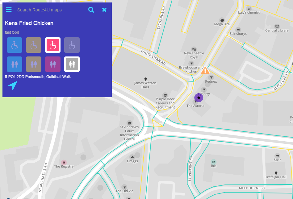
Before the October 1. start of our public test in Portsmouth, we would like YOU to check the map out, and give us feedback. We want to make sure it’s useful for locals and tourists alike. It looks like this now:
Check out the current status here. Right-click the map to plan an accessible route from A to B, or click on the grey circles (they are Points of Interest – POI) to view and assess their accessibility. You can also download the iOS app here, for more features and a much better user experience.
Please help us with these questions, let’s make sure everything is ready before setting sail:
- Is there a pedestrian path connecting Anglesea Road and Guildhall Square? (behind King Henry Building and Park Building?) here: http://route4u.org/maps/#18.05/50.79791/-1.09389/0/1
- Is the path from Guildhall Square to Victoria Park shown correctly on the map? here: http://route4u.org/maps/#18.08/50.79816/-1.09244/0/1
- Surface smoothness of Commercial Road, do you agree it’s convenient “green”? here: http://route4u.org/maps/#18.73/50.80141/-1.08922/0/1
- We love short routes! Do you? Are there any accessible arcades or other shortcuts that are not yet featured on the map of the surveyed area? See an example here: http://route4u.org/maps/#19.22/50.79659/-1.09253/0/1
- You can show us your preferred routes (even if they’re not yet on the map) by tapping the “ruler” icon in the bottom left corner of the map in our iPhone app.
- Have you encountered any map errors regarding sidewalk surfaces, crossings, curbs? You can pin them for review inside the app. Just make a long tap on the map and choose “Obstacle”. Please choose “Map improvement” and if you can, attach a photo of the problematic area by tapping the camera icon above the red face.
Since you’re definitely an early adopter,
Feel free to write a note in our mapping group about anything Route4U related, or send an email to our cartographer: tibor@route4u.org
If you feel like, you can start the public testing right away! By clicking on the grey circles on the map around you, you can assess their accessibility. The information becomes available to everyone in less then an hour! If you encounter any obstacles – temporary or permanent – why not put them on the map, as it is mentioned above? The Route4U route planner now takes this into consideration during sidewalk navigation!
You are amazing, thank You! 🙂
Oh and there’s more: during our campaign in October we’ll be solving a nice, online community puzzle game together. – Stay tuned!